
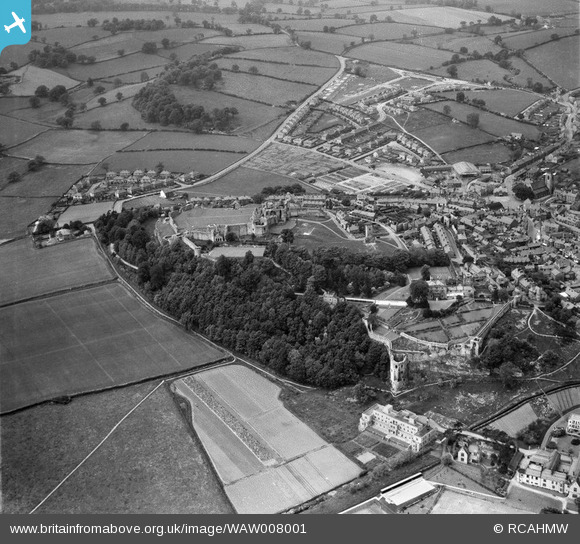
WAW008001 WALES (1947). View of Denbigh showing castle and new housing
© Copyright OpenStreetMap contributors and licensed by the OpenStreetMap Foundation. 2024. Cartography is licensed as CC BY-SA.
Nearby Images (4)
WAW007995

WAW007999

WAW008001

WAW008002

Details
| Title | [WAW008001] View of Denbigh showing castle and new housing |
| Reference | WAW008001 |
| Date | 30-June-1947 |
| Link | Coflein Archive Item 6413561 |
| Place name | |
| Parish | |
| District | |
| Country | WALES |
| Easting / Northing | 305260, 366110 |
| Longitude / Latitude | -3.4178948504298, 53.183353682004 |
| National Grid Reference | SJ053661 |
Pins
 Gatreli |
Wednesday 28th of June 2023 03:12:57 PM | |
Gatreli |
Wednesday 28th of June 2023 03:12:39 PM | |
REEDWARDS |
Monday 15th of February 2016 09:41:40 AM | |
REEDWARDS |
Sunday 14th of February 2016 05:42:13 PM | |
REEDWARDS |
Sunday 14th of February 2016 05:41:38 PM | |
REEDWARDS |
Saturday 13th of February 2016 05:03:00 PM | |
REEDWARDS |
Saturday 13th of February 2016 05:02:25 PM | |
REEDWARDS |
Saturday 13th of February 2016 04:56:16 PM | |
REEDWARDS |
Saturday 13th of February 2016 04:53:17 PM | |
REEDWARDS |
Saturday 13th of February 2016 04:53:15 PM |


