
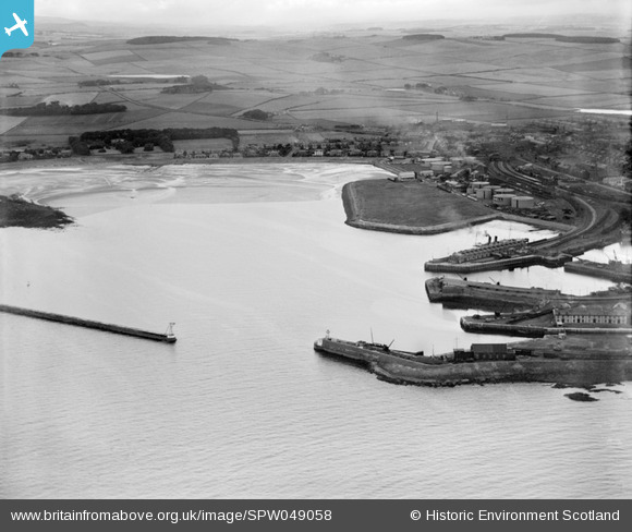
SPW049058 SCOTLAND (1935). Ardrossan, general view, showing Ardrossan Harbour and North Crescent Road. An oblique aerial photograph taken facing north.
© Copyright OpenStreetMap contributors and licensed by the OpenStreetMap Foundation. 2024. Cartography is licensed as CC BY-SA.
Nearby Images (14)
SAW011547

SAW011553

SPW049047

SPW049058

SPW050807

SPW050814

SAW011548

SAW011551

SPW050787

SPW050794

SPW050810

SPW050811

SPW050816

SPW050812

Details
| Title | [SPW049058] Ardrossan, general view, showing Ardrossan Harbour and North Crescent Road. An oblique aerial photograph taken facing north. |
| Reference | SPW049058 |
| Date | 1935 |
| Link | Canmore Collection item 1257966 |
| Place name | |
| Parish | ARDROSSAN |
| District | CUNNINGHAME |
| Country | SCOTLAND |
| Easting / Northing | 222700, 642500 |
| Longitude / Latitude | -4.8176327050792, 55.643650407052 |
| National Grid Reference | NS227425 |
Pins
Be the first to add a comment to this image!


