
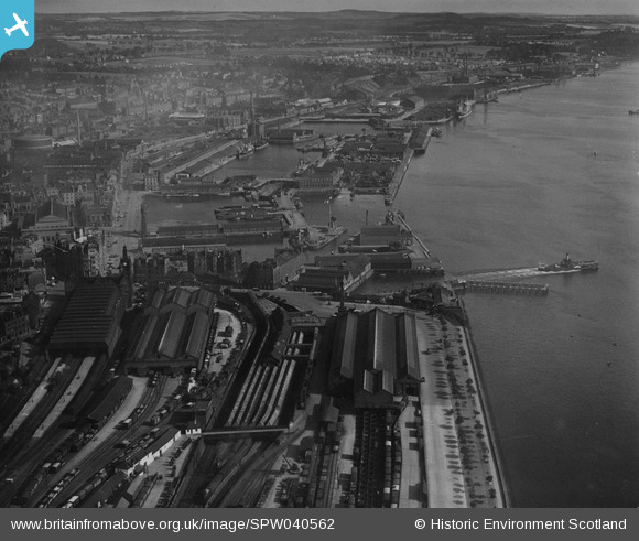
SPW040562 SCOTLAND (1932). Dundee, general view, showing Dundee Docks and Tay Bridge Station. An oblique aerial photograph taken facing north-east. This image has been produced from a print.
© Copyright OpenStreetMap contributors and licensed by the OpenStreetMap Foundation. 2024. Cartography is licensed as CC BY-SA.
Nearby Images (8)
SPW040562

SPW019937

SPW019939

SPW022110

SPW040561

SPW042547

SPW019925

SPW022103

Details
| Title | [SPW040562] Dundee, general view, showing Dundee Docks and Tay Bridge Station. An oblique aerial photograph taken facing north-east. This image has been produced from a print. |
| Reference | SPW040562 |
| Date | 1932 |
| Link | Canmore Collection item 1315553 |
| Place name | |
| Parish | DUNDEE (DUNDEE, CITY OF) |
| District | CITY OF DUNDEE |
| Country | SCOTLAND |
| Easting / Northing | 340510, 729920 |
| Longitude / Latitude | -2.9654098941835, 56.457774323868 |
| National Grid Reference | NO405299 |
Pins
Be the first to add a comment to this image!


