
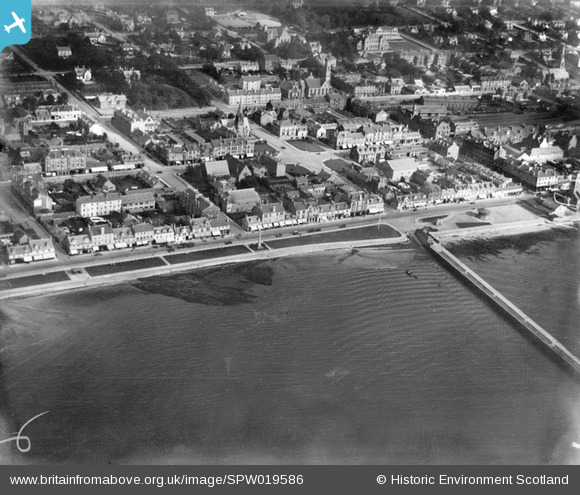
SPW019586 SCOTLAND (1927). Helensburgh, general view, showing Colquhoun Square and Helensburgh Pier. An oblique aerial photograph taken facing east.
© Copyright OpenStreetMap contributors and licensed by the OpenStreetMap Foundation. 2024. Cartography is licensed as CC BY-SA.
Nearby Images (4)
SPW019586

SAW026580

SPW035688

SPW019584

Details
| Title | [SPW019586] Helensburgh, general view, showing Colquhoun Square and Helensburgh Pier. An oblique aerial photograph taken facing east. |
| Reference | SPW019586 |
| Date | 1927 |
| Link | Canmore Collection item 1259186 |
| Place name | |
| Parish | RHU |
| District | DUMBARTON |
| Country | SCOTLAND |
| Easting / Northing | 229446, 682342 |
| Longitude / Latitude | -4.7355616892048, 56.003679680874 |
| National Grid Reference | NS294823 |
Pins
 Billy Turner |
Wednesday 25th of May 2016 08:17:58 PM | |
 olddobson |
Monday 26th of August 2013 07:10:35 PM |


