
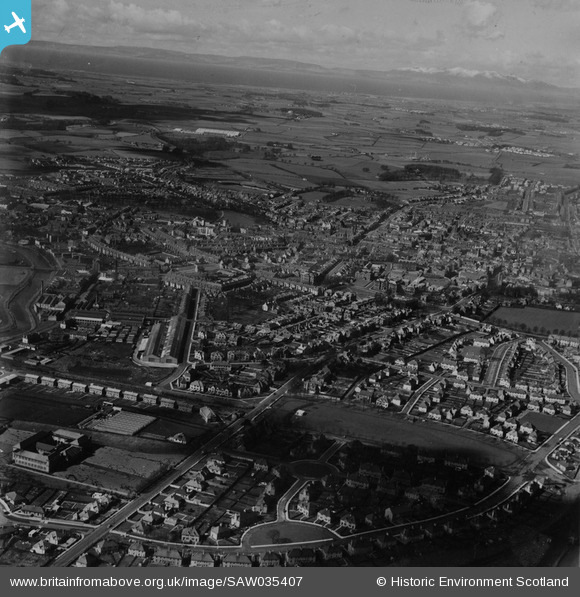
SAW035407 SCOTLAND (1951). Kilmarnock, general view, showing Piersland Park and Mackinlay Place. An oblique aerial photograph taken facing west. This image has been produced from a print.
© Copyright OpenStreetMap contributors and licensed by the OpenStreetMap Foundation. 2024. Cartography is licensed as CC BY-SA.
Nearby Images (2)
SAW035407

SPW019531

Details
| Title | [SAW035407] Kilmarnock, general view, showing Piersland Park and Mackinlay Place. An oblique aerial photograph taken facing west. This image has been produced from a print. |
| Reference | SAW035407 |
| Date | 1951 |
| Link | Canmore Collection item 1315233 |
| Place name | |
| Parish | KILMARNOCK |
| District | KILMARNOCK AND LOUDOUN |
| Country | SCOTLAND |
| Easting / Northing | 243155, 637642 |
| Longitude / Latitude | -4.4901627919218, 55.607066558764 |
| National Grid Reference | NS432376 |
Pins
 KillieDee |
Thursday 29th of July 2021 02:03:52 PM | |
KillieDee |
Wednesday 5th of June 2019 11:14:15 AM | |
KillieDee |
Wednesday 5th of June 2019 11:12:51 AM | |
KillieDee |
Wednesday 27th of March 2019 12:54:37 PM | |
KillieDee |
Wednesday 27th of March 2019 12:51:24 PM | |
Mackay16 |
Monday 4th of April 2016 03:51:20 PM | |
Mackay16 |
Monday 4th of April 2016 03:21:05 PM | |
Mackay16 |
Monday 4th of April 2016 03:18:11 PM | |
Mackay16 |
Monday 4th of April 2016 03:15:53 PM | |
Mackay16 |
Monday 4th of April 2016 03:14:38 PM | |
aayjay |
Monday 6th of October 2014 03:26:34 PM | |
tall guy |
Saturday 16th of August 2014 08:00:15 PM | |
BobbyS |
Saturday 11th of May 2013 09:12:54 PM |


