
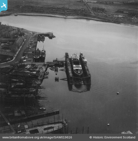
SAW019616 SCOTLAND (1948). Dry Dock, Pocra Quay, Aberdeen Harbour. An oblique aerial photograph taken facing south-east. This image has been produced from a print.
© Copyright OpenStreetMap contributors and licensed by the OpenStreetMap Foundation. 2024. Cartography is licensed as CC BY-SA.
Nearby Images (12)
SAW019616

SAW019617

SAW022568

SAW022567

SAW022569

SPW059985

SPW059986

SPW059987

SPW059988

SPW059989

SPW059990

SPW059991

Details
| Title | [SAW019616] Dry Dock, Pocra Quay, Aberdeen Harbour. An oblique aerial photograph taken facing south-east. This image has been produced from a print. |
| Reference | SAW019616 |
| Date | 1948 |
| Link | Canmore Collection item 1314989 |
| Place name | |
| Parish | ABERDEEN |
| District | CITY OF ABERDEEN |
| Country | SCOTLAND |
| Easting / Northing | 395620, 805800 |
| Longitude / Latitude | -2.0723866673161, 57.143257013446 |
| National Grid Reference | NJ956058 |
Pins
Be the first to add a comment to this image!
User Comment Contributions
One of the "flat iron" colliers built by Hall Russell |
 japottinger |
Friday 14th of June 2013 08:56:58 PM |


