
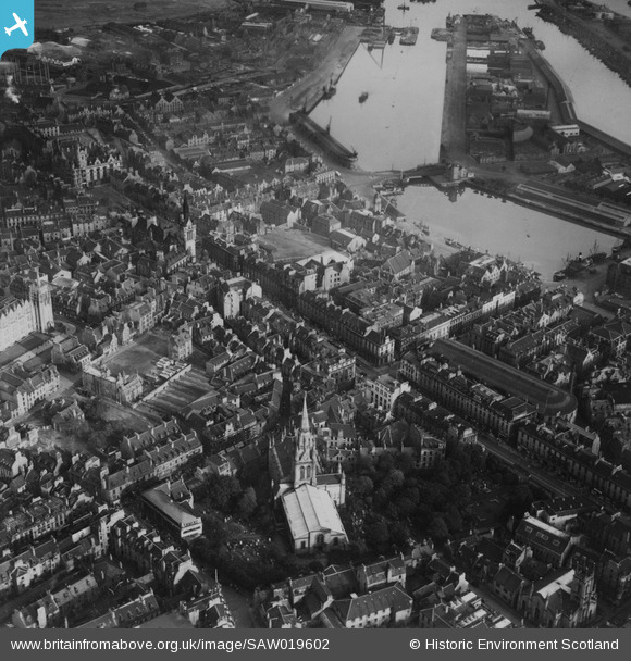
SAW019602 SCOTLAND (1948). Aberdeen, general view, showing Kirk of St Nicholas, Union Street and Victoria Dock. An oblique aerial photograph taken facing east. This image has been produced from a print.
© Copyright OpenStreetMap contributors and licensed by the OpenStreetMap Foundation. 2024. Cartography is licensed as CC BY-SA.
Nearby Images (28)
SAW019602

SAW019599

SAW019603

SAW019607

SAW019601

SAW022551

SAW022555

SAW022556

SAW022557

SAW014826

SAW022553

SAW014827

SAW019606

SAW022558

SAW022563

SAW022552

SAW022562

SAW022560

SAW022564

SAW022554

SAW022561

SAW019612

SAW019605

SPW022072

SAW019618

SPW022071

SPW060049

SAW019609

Details
| Title | [SAW019602] Aberdeen, general view, showing Kirk of St Nicholas, Union Street and Victoria Dock. An oblique aerial photograph taken facing east. This image has been produced from a print. |
| Reference | SAW019602 |
| Date | 1948 |
| Link | Canmore Collection item 1314978 |
| Place name | |
| Parish | ABERDEEN |
| District | CITY OF ABERDEEN |
| Country | SCOTLAND |
| Easting / Northing | 394270, 806245 |
| Longitude / Latitude | -2.0947078078587, 57.147240071511 |
| National Grid Reference | NJ943062 |
Pins
Be the first to add a comment to this image!


