
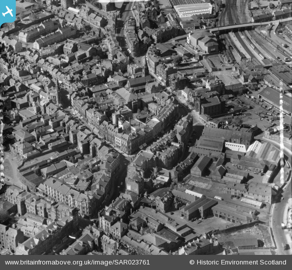
SAR023761 SCOTLAND (1955). General View Stirling, Stirlingshire, Scotland. An oblique aerial photograph taken facing North. This image was marked by AeroPictorial Ltd for photo editing.
© Copyright OpenStreetMap contributors and licensed by the OpenStreetMap Foundation. 2024. Cartography is licensed as CC BY-SA.
Nearby Images (14)
SAR008641

SAR008642

SAR008643

SAR018751

SAR019988

SAR023761

SPW020257

SPW040343

SPW040342

SPW040346

SAW024464

SPW040345

SPW020316

SAW024463

Details
| Title | [SAR023761] General View Stirling, Stirlingshire, Scotland. An oblique aerial photograph taken facing North. This image was marked by AeroPictorial Ltd for photo editing. |
| Reference | SAR023761 |
| Date | 1955 |
| Link | Canmore Collection item 1438364 |
| Place name | |
| Parish | STIRLING |
| District | STIRLING |
| Country | SCOTLAND |
| Easting / Northing | 279634, 693578 |
| Longitude / Latitude | -3.9362580024794, 56.119809167292 |
| National Grid Reference | NS796936 |
Pins
Be the first to add a comment to this image!


