
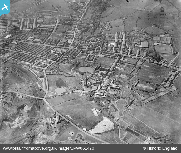
EPW061420 ENGLAND (1939). Hollins, Darwen, from the north-east, 1939
© Copyright OpenStreetMap contributors and licensed by the OpenStreetMap Foundation. 2024. Cartography is licensed as CC BY-SA.
Nearby Images (12)
EPW061420

EPW041919

EPW041920

EPW041921

EPW061422

EPW041922

EPW041918

EPW041916

EPW061427

EPW061419

EPW041915

EPW061424

Details
| Title | [EPW061420] Hollins, Darwen, from the north-east, 1939 |
| Reference | EPW061420 |
| Date | 4-June-1939 |
| Link | |
| Place name | DARWEN |
| Parish | |
| District | |
| Country | ENGLAND |
| Easting / Northing | 368894, 423857 |
| Longitude / Latitude | -2.4713192990815, 53.709982829696 |
| National Grid Reference | SD689239 |
Pins
 jmc223 |
Thursday 3rd of August 2017 05:32:36 PM |


