
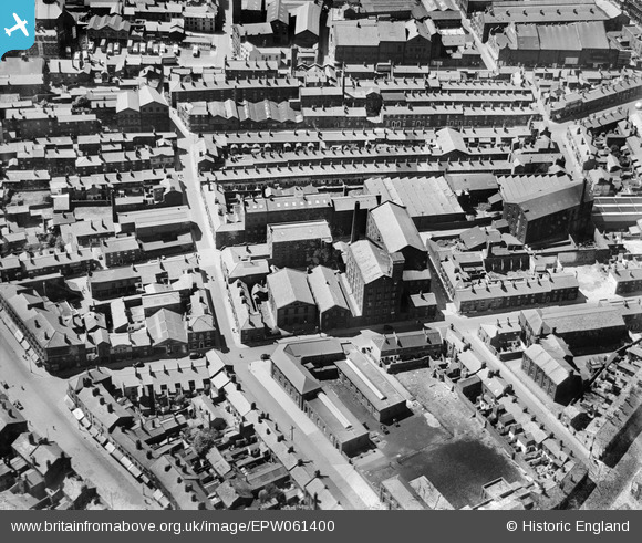
EPW061400 ENGLAND (1939). Lord's Walk, Pole Street and environs, Preston, 1939
© Copyright OpenStreetMap contributors and licensed by the OpenStreetMap Foundation. 2024. Cartography is licensed as CC BY-SA.
Nearby Images (13)
EPW061400

EPW061406

EPW061401

EPW061403

EAW023381
 and environs, Preston, 1949")
EAW023380

EAW015902

EAW015906

EAW015909

EAW015903

EPW061404

EPW061405

EPW061402

Details
| Title | [EPW061400] Lord's Walk, Pole Street and environs, Preston, 1939 |
| Reference | EPW061400 |
| Date | 2-June-1939 |
| Link | |
| Place name | PRESTON |
| Parish | |
| District | |
| Country | ENGLAND |
| Easting / Northing | 354323, 429602 |
| Longitude / Latitude | -2.6929335341102, 53.760549645989 |
| National Grid Reference | SD543296 |
Pins
 Robert - Cumbria |
Thursday 6th of February 2014 10:36:22 PM | |
Robert - Cumbria |
Thursday 6th of February 2014 10:35:07 PM | |
Robert - Cumbria |
Thursday 6th of February 2014 10:26:42 PM | |
Robert - Cumbria |
Thursday 6th of February 2014 09:00:57 PM | |
Robert - Cumbria |
Thursday 6th of February 2014 08:59:21 PM | |
Robert - Cumbria |
Thursday 6th of February 2014 08:57:46 PM | |
Robert - Cumbria |
Thursday 6th of February 2014 08:56:45 PM | |
Robert - Cumbria |
Thursday 6th of February 2014 08:52:46 PM | |
Robert - Cumbria |
Thursday 6th of February 2014 08:52:17 PM | |
Robert - Cumbria |
Thursday 6th of February 2014 08:51:39 PM | |
Robert - Cumbria |
Thursday 6th of February 2014 08:51:13 PM |


