
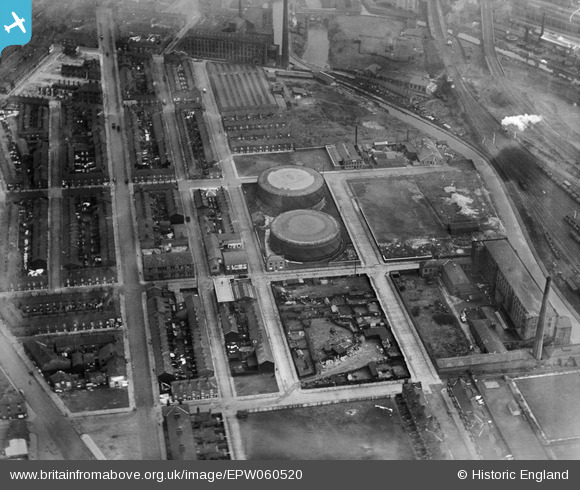
EPW060520 ENGLAND (1939). The town gas holders off Hertford Street, Ashton-Under-Lyne, 1939
© Copyright OpenStreetMap contributors and licensed by the OpenStreetMap Foundation. 2024. Cartography is licensed as CC BY-SA.
Nearby Images (4)
EPW060520

EPW060518

EPW060522

EPW060521

Details
| Title | [EPW060520] The town gas holders off Hertford Street, Ashton-Under-Lyne, 1939 |
| Reference | EPW060520 |
| Date | 13-February-1939 |
| Link | |
| Place name | ASHTON-UNDER-LYNE |
| Parish | |
| District | |
| Country | ENGLAND |
| Easting / Northing | 393146, 398176 |
| Longitude / Latitude | -2.1032893153437, 53.480010531071 |
| National Grid Reference | SJ931982 |
Pins
 Howard Porter |
Thursday 5th of July 2018 04:06:21 PM | |
Barney Rubble |
Friday 25th of May 2018 09:59:53 AM | |
Barney Rubble |
Friday 25th of May 2018 09:57:40 AM | |
Barney Rubble |
Friday 25th of May 2018 09:56:33 AM | |
TheBlueCube |
Tuesday 28th of October 2014 08:34:42 PM | |
TheBlueCube |
Tuesday 28th of October 2014 08:33:33 PM | |
John T. Pitman |
Friday 17th of October 2014 11:40:59 PM | |
Ian Ashton |
Friday 29th of November 2013 09:06:30 PM |


