
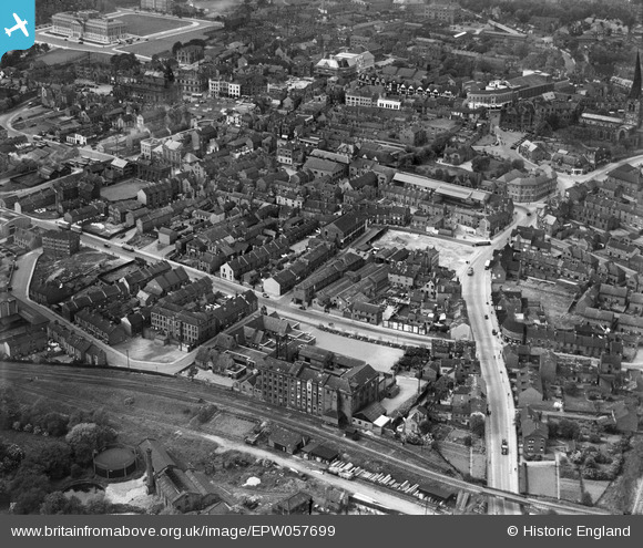
EPW057699 ENGLAND (1938). Lordsmill Street, Markham Road and the town centre, Chesterfield, 1938
© Copyright OpenStreetMap contributors and licensed by the OpenStreetMap Foundation. 2024. Cartography is licensed as CC BY-SA.
Nearby Images (6)
EPW057699

EPW021083

EPW021084

EPW021079

EPW021076

EPW057701

Details
| Title | [EPW057699] Lordsmill Street, Markham Road and the town centre, Chesterfield, 1938 |
| Reference | EPW057699 |
| Date | 20-June-1938 |
| Link | |
| Place name | CHESTERFIELD |
| Parish | |
| District | |
| Country | ENGLAND |
| Easting / Northing | 438445, 370885 |
| Longitude / Latitude | -1.42396961943, 53.233326121386 |
| National Grid Reference | SK384709 |
Pins
 Phil G. |
Thursday 5th of April 2018 10:27:07 PM | |
John W |
Tuesday 20th of December 2016 02:49:12 PM | |
speedypete |
Friday 23rd of October 2015 09:20:45 AM | |
RichardL |
Tuesday 5th of August 2014 08:10:07 AM | |
RichardL |
Tuesday 5th of August 2014 08:08:20 AM | |
Pete L |
Thursday 16th of January 2014 09:21:49 PM | |
Pete L |
Thursday 16th of January 2014 09:17:05 PM | |
Pete L |
Thursday 16th of January 2014 09:16:09 PM |


