
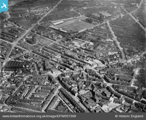
EPW057398 ENGLAND (1938). St Mary's Church, Bramall Lane Football Ground and the surrounding area, Sheffield, 1938. This image has been produced from a copy-negative.
© Copyright OpenStreetMap contributors and licensed by the OpenStreetMap Foundation. 2024. Cartography is licensed as CC BY-SA.
Nearby Images (20)
EPW057398

EAW014679

EAW014680

EAW014682

EAW014681

EAW014674

EAW014675

EAW014665

EAW014676

EAW014664

EAW014678

EAW014677

EAW014662

EAW014663

EAW014684

EAW014683

EAW038451

EAW025215

EAW038450

EAW042505

Details
| Title | [EPW057398] St Mary's Church, Bramall Lane Football Ground and the surrounding area, Sheffield, 1938. This image has been produced from a copy-negative. |
| Reference | EPW057398 |
| Date | 3-June-1938 |
| Link | |
| Place name | SHEFFIELD |
| Parish | |
| District | |
| Country | ENGLAND |
| Easting / Northing | 434998, 386250 |
| Longitude / Latitude | -1.4739194940107, 53.37168634743 |
| National Grid Reference | SK350863 |
Pins
 peter photo |
Wednesday 6th of March 2024 05:20:45 PM | |
jal |
Wednesday 17th of July 2019 07:47:04 AM | |
jal |
Wednesday 17th of July 2019 07:46:00 AM | |
jal |
Wednesday 17th of July 2019 07:42:16 AM |


