
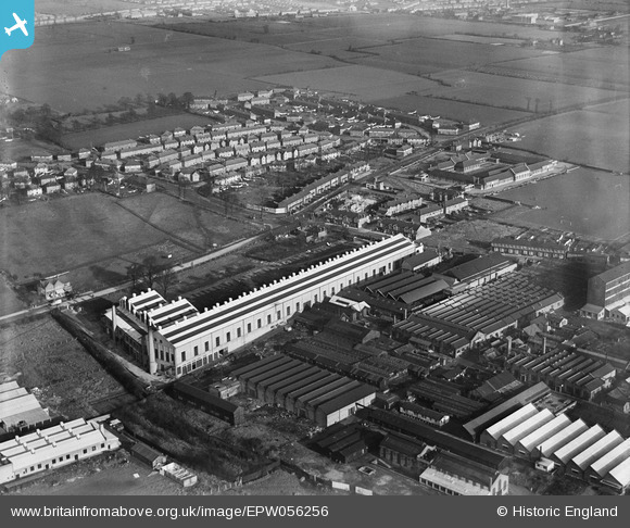
EPW056256 ENGLAND (1938). Ismay Cables Ltd and environs, Dagenham, 1938
© Copyright OpenStreetMap contributors and licensed by the OpenStreetMap Foundation. 2024. Cartography is licensed as CC BY-SA.
Nearby Images (18)
EPW056256

EPW056254

EPW056253

EPW056255

EPW008521

EPW008523

EPW056251

EPW056252

EPW008528

EPW008523A

EPW008524

EPW005613

EPW008527

EPW008520

EPW005610

EPW008522

EPW005615

EAW040650

Details
| Title | [EPW056256] Ismay Cables Ltd and environs, Dagenham, 1938 |
| Reference | EPW056256 |
| Date | 17-January-1938 |
| Link | |
| Place name | DAGENHAM |
| Parish | |
| District | |
| Country | ENGLAND |
| Easting / Northing | 549881, 185784 |
| Longitude / Latitude | 0.16198702307444, 51.550532426999 |
| National Grid Reference | TQ499858 |
Pins
Be the first to add a comment to this image!


