
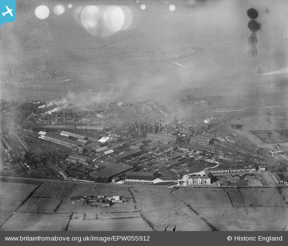
EPW055912 ENGLAND (1937). The South Durham Iron and Steel Works, South Bank, from the south-east, 1937. This image has been produced from a damaged negative.
© Copyright OpenStreetMap contributors and licensed by the OpenStreetMap Foundation. 2024. Cartography is licensed as CC BY-SA.
Nearby Images (4)
EPW055912

EPW055924

EPW055913

EPW055911

Details
| Title | [EPW055912] The South Durham Iron and Steel Works, South Bank, from the south-east, 1937. This image has been produced from a damaged negative. |
| Reference | EPW055912 |
| Date | 28-October-1937 |
| Link | |
| Place name | SOUTH BANK |
| Parish | |
| District | |
| Country | ENGLAND |
| Easting / Northing | 452340, 520339 |
| Longitude / Latitude | -1.1902253912342, 54.575428708521 |
| National Grid Reference | NZ523203 |
Pins
 Class31 |
Tuesday 21st of January 2014 10:42:18 PM |


