
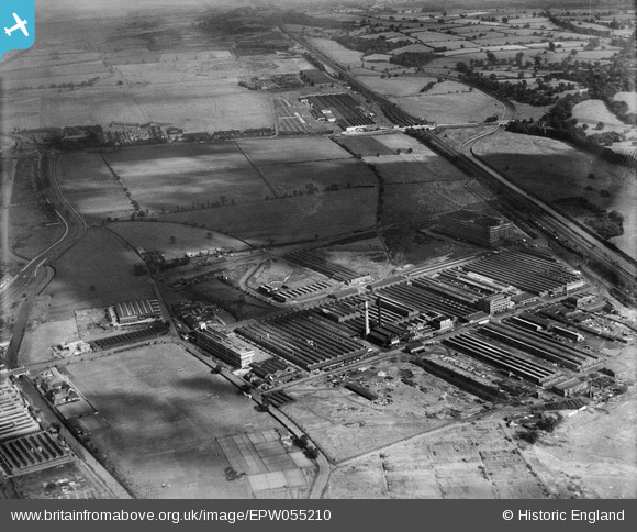
EPW055210 ENGLAND (1937). The Fort Dunlop Rubber Works, Bromford, 1937
© Copyright OpenStreetMap contributors and licensed by the OpenStreetMap Foundation. 2024. Cartography is licensed as CC BY-SA.
Nearby Images (9)
EPW055210

EPW055211

EPW055213

EPW055216

EPW026932

EPW022583

EPW026942

EPW055214

EPW022582

Details
| Title | [EPW055210] The Fort Dunlop Rubber Works, Bromford, 1937 |
| Reference | EPW055210 |
| Date | 4-September-1937 |
| Link | |
| Place name | BROMFORD |
| Parish | |
| District | |
| Country | ENGLAND |
| Easting / Northing | 412843, 290502 |
| Longitude / Latitude | -1.8107376687005, 52.511890449231 |
| National Grid Reference | SP128905 |


