
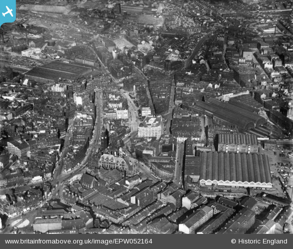
EPW052164 ENGLAND (1936). Market Street and the city centre, Bradford, 1936. This image has been produced from a print.
© Copyright OpenStreetMap contributors and licensed by the OpenStreetMap Foundation. 2024. Cartography is licensed as CC BY-SA.
Nearby Images (18)
EPW052164

EPW045330

EPW045329

EPW054315

EPW054312

EPW054316

EPW024505

EPW024409

EPW057189

EPW057191

EAW030800

EPW057184

EPW024395

EPW054313

EPW054323

EPW024392

EPW057183

EPW024521

Details
| Title | [EPW052164] Market Street and the city centre, Bradford, 1936. This image has been produced from a print. |
| Reference | EPW052164 |
| Date | October-1936 |
| Link | |
| Place name | BRADFORD |
| Parish | |
| District | |
| Country | ENGLAND |
| Easting / Northing | 416482, 433022 |
| Longitude / Latitude | -1.7497716538096, 53.793033721597 |
| National Grid Reference | SE165330 |
Pins
Be the first to add a comment to this image!


