
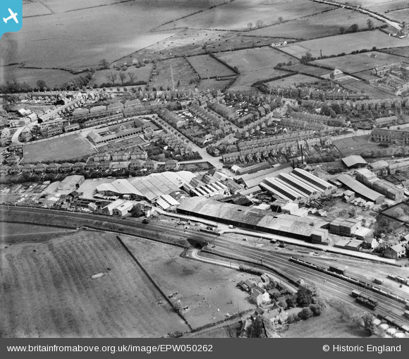
EPW050262 ENGLAND (1936). The Midland Woodworking Saw Mill and the surrounding residential area, Melton Mowbray, 1936
© Copyright OpenStreetMap contributors and licensed by the OpenStreetMap Foundation. 2024. Cartography is licensed as CC BY-SA.
Nearby Images (20)
EPW050262

EPW050264

EPW038045

EPW050257

EPW037860

EPW038042

EPW037856

EPW037859

EPW037858

EPW038043

EPW038044

EPW037857

EPW050263

EPW038041

EPW050258

EPW050261

EPW037861

EPW050260

EPW050259

EPW050256

Details
| Title | [EPW050262] The Midland Woodworking Saw Mill and the surrounding residential area, Melton Mowbray, 1936 |
| Reference | EPW050262 |
| Date | May-1936 |
| Link | |
| Place name | MELTON MOWBRAY |
| Parish | |
| District | |
| Country | ENGLAND |
| Easting / Northing | 475778, 319603 |
| Longitude / Latitude | -0.8767195833171, 52.76836434955 |
| National Grid Reference | SK758196 |
Pins
Be the first to add a comment to this image!


