
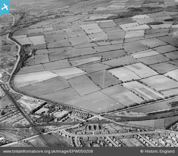
EPW050208 ENGLAND (1936). Fields to the north of Basford Isolation Hospital, Old Basford, from the south, 1936
© Copyright OpenStreetMap contributors and licensed by the OpenStreetMap Foundation. 2024. Cartography is licensed as CC BY-SA.
Nearby Images (3)
EPW050208

EPW050210

EPW050204

Details
| Title | [EPW050208] Fields to the north of Basford Isolation Hospital, Old Basford, from the south, 1936 |
| Reference | EPW050208 |
| Date | May-1936 |
| Link | |
| Place name | OLD BASFORD |
| Parish | |
| District | |
| Country | ENGLAND |
| Easting / Northing | 455769, 344357 |
| Longitude / Latitude | -1.1690359022673, 52.993326575597 |
| National Grid Reference | SK558444 |
Pins
 KC |
Thursday 17th of September 2020 03:05:21 PM | |
snowhead |
Friday 19th of July 2019 04:59:47 PM | |
upthemaggies |
Friday 12th of July 2013 01:42:21 PM | |
upthemaggies |
Friday 12th of July 2013 01:41:38 PM | |
upthemaggies |
Friday 12th of July 2013 01:37:49 PM | |
upthemaggies |
Friday 12th of July 2013 01:37:07 PM | |
Sarah |
Sunday 7th of July 2013 10:26:47 PM |


