
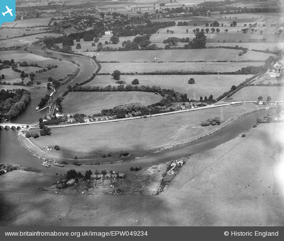
EPW049234 ENGLAND (1935). Chertsey Bridge Road and the Sports Ground, Chertsey, from the south-east, 1935
© Copyright OpenStreetMap contributors and licensed by the OpenStreetMap Foundation. 2024. Cartography is licensed as CC BY-SA.
Nearby Images (5)
EPW049234

EPW049231

EPW049232

EPW049233

EPW058804

Details
| Title | [EPW049234] Chertsey Bridge Road and the Sports Ground, Chertsey, from the south-east, 1935 |
| Reference | EPW049234 |
| Date | September-1935 |
| Link | |
| Place name | CHERTSEY |
| Parish | |
| District | |
| Country | ENGLAND |
| Easting / Northing | 505756, 166396 |
| Longitude / Latitude | -0.48001336859052, 51.38624615073 |
| National Grid Reference | TQ058664 |


