
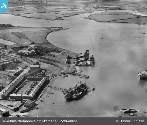
EPW048829 ENGLAND (1935). Cowpen Colliery (Bates Pit) railway sidings and staiths, and the River Blyth and surrounding countryside, Blyth, from the east, 1935
© Copyright OpenStreetMap contributors and licensed by the OpenStreetMap Foundation. 2024. Cartography is licensed as CC BY-SA.
Nearby Images (6)
EPW048829
 railway sidings and staiths, and the River Blyth and surrounding countryside, Blyth, from the east, 1935")
EPW048833
 railway sidings and staiths, the River Blyth and Battleship Wharf, Blyth, 1935")
EPW048831

EPW048835

EAW013067

EAW013069

Details
| Title | [EPW048829] Cowpen Colliery (Bates Pit) railway sidings and staiths, and the River Blyth and surrounding countryside, Blyth, from the east, 1935 |
| Reference | EPW048829 |
| Date | August-1935 |
| Link | |
| Place name | BLYTH |
| Parish | BLYTH |
| District | |
| Country | ENGLAND |
| Easting / Northing | 430931, 582389 |
| Longitude / Latitude | -1.5147880287065, 55.134842052887 |
| National Grid Reference | NZ309824 |
Pins
Be the first to add a comment to this image!


