
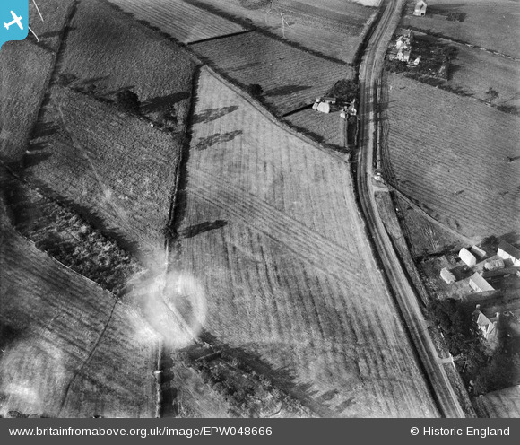
EPW048666 ENGLAND (1935). Farmland at Carrington's Farm, Smalley, 1935. This image has been produced from a damaged negative.
© Copyright OpenStreetMap contributors and licensed by the OpenStreetMap Foundation. 2024. Cartography is licensed as CC BY-SA.
Nearby Images (48)
EPW048666

EAW018413

EAW011250

EAW011248

EAW018407

EAW018406

EAW025920

EPW048665

EAW025923

EAW017953

EAW017985

EAW011247

EAW017962

EAW011249

EAW018416

EAW011240

EAW018402

EAW011242

EAW012054

EAW017948

EAW012050

EAW018412

EAW011246

EAW017955

EAW018401

EAW017954

EAW018411

EAW012046

EAW012045

EAW011241

EAW011239

EAW012056

EAW012053

EAW012043

EAW011237

EAW018415

EPW048664

EAW011236

EAW011234

EAW025912

EAW017963

EAW011235

EAW012052

EAW033473

EAW033474

EAW025913

EAW012049

EAW018408

Details
| Title | [EPW048666] Farmland at Carrington's Farm, Smalley, 1935. This image has been produced from a damaged negative. |
| Reference | EPW048666 |
| Date | July-1935 |
| Link | |
| Place name | SMALLEY |
| Parish | SMALLEY |
| District | |
| Country | ENGLAND |
| Easting / Northing | 441221, 345302 |
| Longitude / Latitude | -1.3856660881267, 53.0031390262 |
| National Grid Reference | SK412453 |
Pins
 Class31 |
Monday 14th of April 2014 09:15:08 AM | |
 TomRobin |
Monday 9th of December 2013 06:04:33 PM | |
TomRobin |
Monday 9th of December 2013 06:03:41 PM | |
TomRobin |
Monday 9th of December 2013 06:03:22 PM | |
Class31 |
Wednesday 27th of November 2013 09:32:44 AM |
User Comment Contributions
It's great to get a location for this group of images, given the dramatic post-WWII changes in the area. We'll update the catalogue and post the new data here in due course. Yours, Katy Britain from Above Cataloguing Team Leader |
Katy Whitaker |
Wednesday 8th of January 2014 10:24:30 AM |
Looking north east. |
Class31 |
Saturday 4th of January 2014 11:22:21 AM |
See EAW011227 for opencast mining here in 1949 |
TomRobin |
Thursday 2nd of January 2014 04:16:04 PM |
Higher ground on left of picture. |
BigglesH |
Friday 11th of October 2013 02:45:04 AM |
I think EPW048664 EPW048665 (EPW048666) EPW048667 are of same area. |
Andrew Bennett |
Sunday 6th of October 2013 11:22:56 PM |
See also EPW048665. |
BigglesH |
Thursday 16th of May 2013 02:00:45 AM |


