
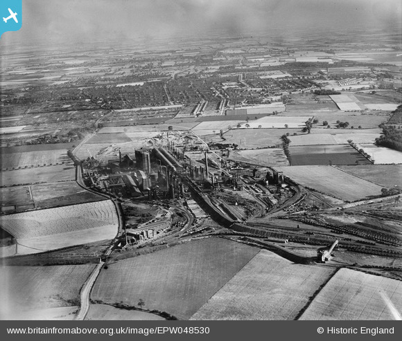
EPW048530 ENGLAND (1935). The John Lysaght Normanby Park Steel Works, Scunthorpe, from the north, 1935
© Copyright OpenStreetMap contributors and licensed by the OpenStreetMap Foundation. 2024. Cartography is licensed as CC BY-SA.
Nearby Images (39)
EPW048530

EAW041828

EAW013833

EAW041863

EAW041827

EAW016661

EPW048529

EAW041862

EAW031194

EAW013834

EAW019674

EAW021132

EAW019670

EAW013831

EAW013490

EAW041860

EAW031196

EAW028570

EAW028571

EAW028563

EAW009634

EAW028560

EAW028564

EAW041864

EAW028561

EAW016662

EAW013488

EAW028562

EAW013489

EAW034811

EAW013832

EAW009628

EAW021137

EAW049669

EAW034805

EAW019669

EAW034828

EAW034821

EAW027178

Details
| Title | [EPW048530] The John Lysaght Normanby Park Steel Works, Scunthorpe, from the north, 1935 |
| Reference | EPW048530 |
| Date | July-1935 |
| Link | |
| Place name | SCUNTHORPE |
| Parish | |
| District | |
| Country | ENGLAND |
| Easting / Northing | 488713, 414340 |
| Longitude / Latitude | -0.6587142382231, 53.617844122263 |
| National Grid Reference | SE887143 |
Pins
Be the first to add a comment to this image!


