
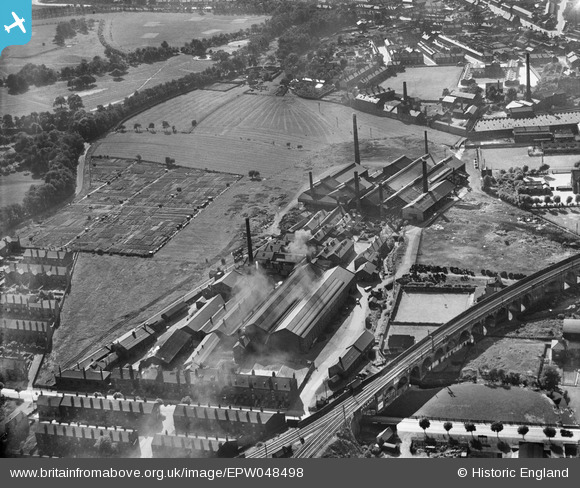
EPW048498 ENGLAND (1935). The British Ropes Ltd Works, Wakefield, 1935
© Copyright OpenStreetMap contributors and licensed by the OpenStreetMap Foundation. 2024. Cartography is licensed as CC BY-SA.
Nearby Images (8)
EPW048498

EPW048493

EPW048497

EPW048495

EPW048496

EPW048500

EPW048499

EPW048494

Details
| Title | [EPW048498] The British Ropes Ltd Works, Wakefield, 1935 |
| Reference | EPW048498 |
| Date | July-1935 |
| Link | |
| Place name | WAKEFIELD |
| Parish | |
| District | |
| Country | ENGLAND |
| Easting / Northing | 432855, 420190 |
| Longitude / Latitude | -1.5025695832522, 53.676913612709 |
| National Grid Reference | SE329202 |
Pins
 sirdouglas |
Thursday 15th of October 2020 04:53:01 PM |


