
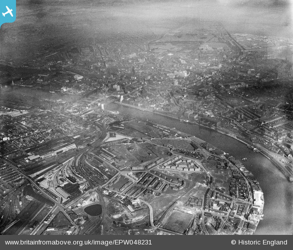
EPW048231 ENGLAND (1935). Salt Meadows alongside the River Tyne, Gateshead, from the east, 1935
© Copyright OpenStreetMap contributors and licensed by the OpenStreetMap Foundation. 2024. Cartography is licensed as CC BY-SA.
Nearby Images (14)
EPW048231

EAW003257

EAW003253

EAW003254

EAW003263

EAW003260

EAW003259

EAW003261

EAW003252

EPW057815

EAW003251

EAW003255

EAW003258

EAW003262

Details
| Title | [EPW048231] Salt Meadows alongside the River Tyne, Gateshead, from the east, 1935 |
| Reference | EPW048231 |
| Date | July-1935 |
| Link | |
| Place name | GATESHEAD |
| Parish | |
| District | |
| Country | ENGLAND |
| Easting / Northing | 426157, 563610 |
| Longitude / Latitude | -1.5913969700766, 54.966351895368 |
| National Grid Reference | NZ262636 |
Pins
 Dylan Moore |
Friday 3rd of May 2013 02:49:25 PM | |
Dylan Moore |
Friday 3rd of May 2013 02:48:36 PM |


