
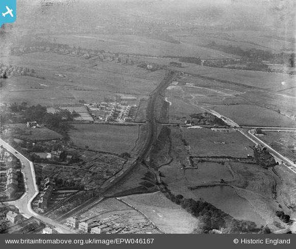
EPW046167 ENGLAND (1934). The Whitefield Branch Railway and Heaton Park, Crumpsall, from the south-east, 1934
© Copyright OpenStreetMap contributors and licensed by the OpenStreetMap Foundation. 2024. Cartography is licensed as CC BY-SA.
Nearby Images (2)
EPW046167

EPW046175

Details
| Title | [EPW046167] The Whitefield Branch Railway and Heaton Park, Crumpsall, from the south-east, 1934 |
| Reference | EPW046167 |
| Date | September-1934 |
| Link | |
| Place name | CRUMPSALL |
| Parish | |
| District | |
| Country | ENGLAND |
| Easting / Northing | 383821, 402996 |
| Longitude / Latitude | -2.2440641660819, 53.523135272575 |
| National Grid Reference | SD838030 |
Pins
 Barney Rubble |
Friday 29th of April 2016 10:38:47 PM | |
Ian Warburton |
Saturday 3rd of January 2015 09:32:20 PM | |
Ian Warburton |
Saturday 3rd of January 2015 09:27:33 PM | |
Ian Warburton |
Saturday 3rd of January 2015 09:23:42 PM | |
Ian Warburton |
Saturday 3rd of January 2015 09:22:12 PM | |
Andy Williams |
Monday 24th of March 2014 01:16:25 PM | |
Andy Williams |
Monday 24th of March 2014 01:13:46 PM | |
Andy Williams |
Monday 24th of March 2014 01:11:24 PM | |
Andy Williams |
Monday 24th of March 2014 01:10:16 PM |


