
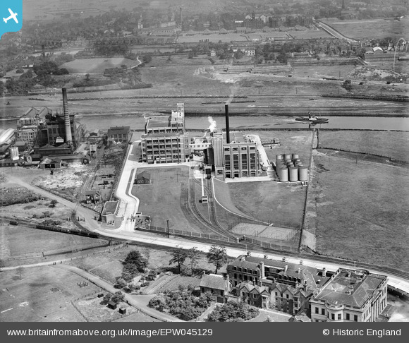
EPW045129 ENGLAND (1934). The Thomas Hedley and Co Soap Factory and environs, Trafford Park, 1934
© Copyright OpenStreetMap contributors and licensed by the OpenStreetMap Foundation. 2024. Cartography is licensed as CC BY-SA.
Nearby Images (12)
EPW045129

EPW045130

EPW041690

EPW045128

EPR000183

EPW041689

EPR000185

EPR000184

EPR000182

EPW027982

EPW027983

EPW027569

Details
| Title | [EPW045129] The Thomas Hedley and Co Soap Factory and environs, Trafford Park, 1934 |
| Reference | EPW045129 |
| Date | July-1934 |
| Link | |
| Place name | TRAFFORD PARK |
| Parish | |
| District | |
| Country | ENGLAND |
| Easting / Northing | 378611, 398043 |
| Longitude / Latitude | -2.3223192066256, 53.4784249316 |
| National Grid Reference | SJ786980 |
Pins
 Stretfordian |
Sunday 21st of January 2018 01:23:09 PM | |
Stretfordian |
Sunday 21st of January 2018 01:16:49 PM | |
Stretfordian |
Sunday 21st of January 2018 12:51:42 PM | |
Stretfordian |
Sunday 21st of January 2018 12:48:23 PM | |
Stretfordian |
Sunday 21st of January 2018 12:46:56 PM | |
Stretfordian |
Sunday 21st of January 2018 12:45:28 PM |


