
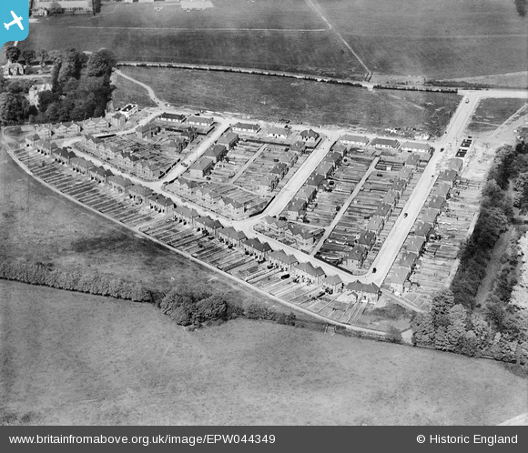
EPW044349 ENGLAND (1934). Fernside Avenue and the edge of the London Air Park, Hanworth Park, 1934
© Copyright OpenStreetMap contributors and licensed by the OpenStreetMap Foundation. 2024. Cartography is licensed as CC BY-SA.
Nearby Images (6)
EPW044349

EPW044352

EPW044348

EPW044351

EPW044350

EPW025753
, Hanworth Park, from the south-west, 1929")
Details
| Title | [EPW044349] Fernside Avenue and the edge of the London Air Park, Hanworth Park, 1934 |
| Reference | EPW044349 |
| Date | May-1934 |
| Link | |
| Place name | HANWORTH PARK |
| Parish | |
| District | |
| Country | ENGLAND |
| Easting / Northing | 510967, 171954 |
| Longitude / Latitude | -0.4034086884112, 51.435212706667 |
| National Grid Reference | TQ110720 |
Pins
Be the first to add a comment to this image!


