
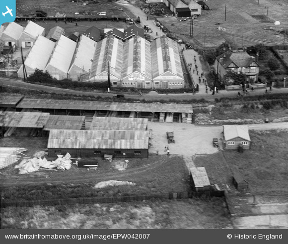
EPW042007 ENGLAND (1933). The McMichael Radio Works and adjacent timber yard on Wexham Road, Slough, 1933
© Copyright OpenStreetMap contributors and licensed by the OpenStreetMap Foundation. 2024. Cartography is licensed as CC BY-SA.
Nearby Images (22)
EPW042007

EPW042005

EPW042004

EPW041905

EPW042006

EPW041908

EPW041907

EPW041906

EPW041909

EPW020652

EPW020650

EPW020651

EPW020654

EPW020655

EPW009941

EPW009944

EPW020653

EPW020649

EPW009940

EPW020648

EPW009942

EPW009939

Details
| Title | [EPW042007] The McMichael Radio Works and adjacent timber yard on Wexham Road, Slough, 1933 |
| Reference | EPW042007 |
| Date | June-1933 |
| Link | |
| Place name | SLOUGH |
| Parish | |
| District | |
| Country | ENGLAND |
| Easting / Northing | 498533, 180437 |
| Longitude / Latitude | -0.57987974268636, 51.513772620446 |
| National Grid Reference | SU985804 |
Pins
Be the first to add a comment to this image!


