
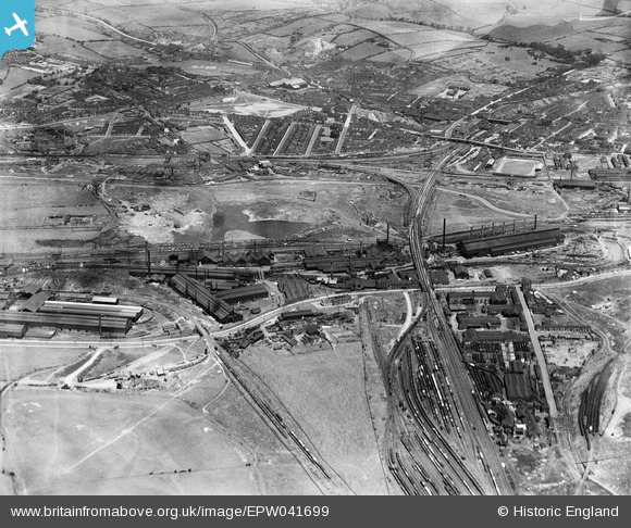
EPW041699 ENGLAND (1933). The Phoenix Special Steel Works, the Rother Iron Works and the town, Rotherham, 1933
© Copyright OpenStreetMap contributors and licensed by the OpenStreetMap Foundation. 2024. Cartography is licensed as CC BY-SA.
Nearby Images (21)
EPW041699

EAW030486

EAW030492

EPW015446

EAW025970

EAW029399

EAW030485

EAW025968

EPW041696

EPW041697

EAW025974

EAW030488

EPW015445

EPW041698

EAW030487

EPW041695

EAW025971

EAW024153

EPW041705

EPW048728

EAW030489

Details
| Title | [EPW041699] The Phoenix Special Steel Works, the Rother Iron Works and the town, Rotherham, 1933 |
| Reference | EPW041699 |
| Date | June-1933 |
| Link | |
| Place name | ROTHERHAM |
| Parish | |
| District | |
| Country | ENGLAND |
| Easting / Northing | 441669, 391955 |
| Longitude / Latitude | -1.3728953945725, 53.422485043119 |
| National Grid Reference | SK417920 |
Pins
 Peter Turvey |
Friday 24th of April 2015 07:07:08 PM |


