
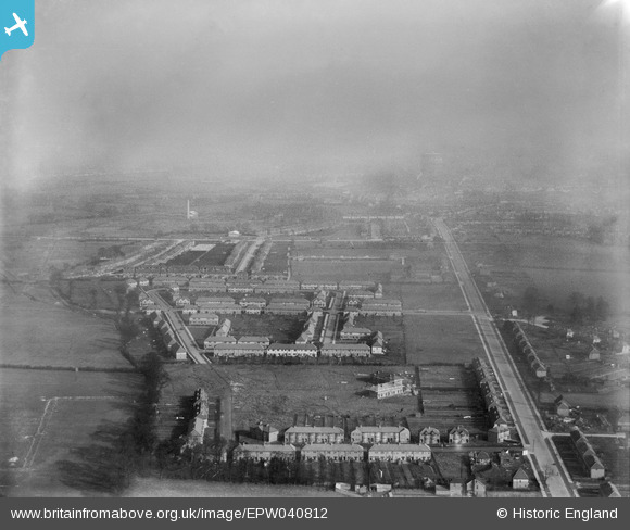
EPW040812 ENGLAND (1933). Eastcote Lane, Stuart Avenue and environs, South Harrow, from the south-west, 1933
© Copyright OpenStreetMap contributors and licensed by the OpenStreetMap Foundation. 2024. Cartography is licensed as CC BY-SA.
Nearby Images (7)
EPW040812

EPW025889

EPW025888

EPW040815

EPW025891

EPW025890

EPW057960

Details
| Title | [EPW040812] Eastcote Lane, Stuart Avenue and environs, South Harrow, from the south-west, 1933 |
| Reference | EPW040812 |
| Date | February-1933 |
| Link | |
| Place name | SOUTH HARROW |
| Parish | |
| District | |
| Country | ENGLAND |
| Easting / Northing | 512725, 186089 |
| Longitude / Latitude | -0.37360833006582, 51.561923580399 |
| National Grid Reference | TQ127861 |
Pins
Be the first to add a comment to this image!


