
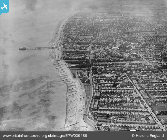
EPW039489 ENGLAND (1932). The town and the seafront, Worthing, 1932
© Copyright OpenStreetMap contributors and licensed by the OpenStreetMap Foundation. 2024. Cartography is licensed as CC BY-SA.
Nearby Images (3)
EPW039489

EPW011534

EPW054072

Details
| Title | [EPW039489] The town and the seafront, Worthing, 1932 |
| Reference | EPW039489 |
| Date | August-1932 |
| Link | |
| Place name | WORTHING |
| Parish | |
| District | |
| Country | ENGLAND |
| Easting / Northing | 515497, 102659 |
| Longitude / Latitude | -0.36046611544822, 50.811389980334 |
| National Grid Reference | TQ155027 |
Pins
 Alan McFaden |
Wednesday 1st of January 2014 03:30:09 PM |

User Comment Contributions
 The Dome Cinema |
Alan McFaden |
Monday 3rd of November 2014 08:59:34 AM |
 Info about the Bandstand history in the Lido |
Alan McFaden |
Monday 3rd of November 2014 08:58:58 AM |
 On Worthing Pier |
Alan McFaden |
Monday 3rd of November 2014 08:57:09 AM |
 Worthing Pier Pavilion renovated 2014 |
Alan McFaden |
Monday 3rd of November 2014 08:56:41 AM |
 Worthing Pier |
Alan McFaden |
Monday 3rd of November 2014 08:55:56 AM |


