
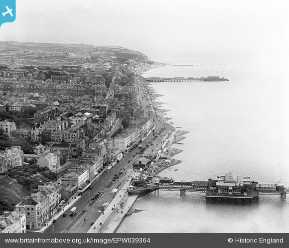
EPW039364 ENGLAND (1932). The Palace Pier, Hastings Pier and the seafront, Hastings, from the west, 1932
© Copyright OpenStreetMap contributors and licensed by the OpenStreetMap Foundation. 2024. Cartography is licensed as CC BY-SA.
Nearby Images (11)
EPW039364

EPW026193

EPW026204

EPW035337

EAW002417

EPW035335

EAW002418

EPW042841

EAW002416

EPW042836

EAW002419

Details
| Title | [EPW039364] The Palace Pier, Hastings Pier and the seafront, Hastings, from the west, 1932 |
| Reference | EPW039364 |
| Date | August-1932 |
| Link | |
| Place name | HASTINGS |
| Parish | |
| District | |
| Country | ENGLAND |
| Easting / Northing | 579873, 108788 |
| Longitude / Latitude | 0.55559229840376, 50.850045390632 |
| National Grid Reference | TQ799088 |
Pins
 John W |
Thursday 4th of May 2017 06:24:12 PM |


