
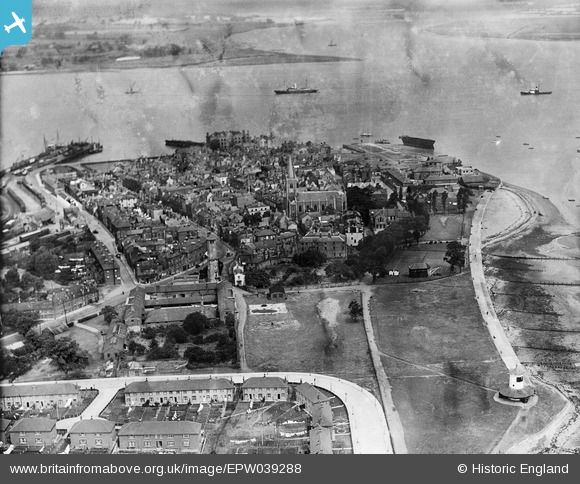
EPW039288 ENGLAND (1932). St Nicholas's Church and the town, Harwich, 1932
© Copyright OpenStreetMap contributors and licensed by the OpenStreetMap Foundation. 2024. Cartography is licensed as CC BY-SA.
Nearby Images (6)
EPW039288

EAW048287

EPW049039

EPW049117

EAW025901

EAW025902

Details
| Title | [EPW039288] St Nicholas's Church and the town, Harwich, 1932 |
| Reference | EPW039288 |
| Date | July-1932 |
| Link | |
| Place name | HARWICH |
| Parish | HARWICH |
| District | |
| Country | ENGLAND |
| Easting / Northing | 626114, 232520 |
| Longitude / Latitude | 1.2903940342632, 51.944712746296 |
| National Grid Reference | TM261325 |
Pins
 Amiguru |
Saturday 15th of March 2014 10:19:00 PM |
User Comment Contributions
A lovely image of Old Harwich.In the SE corner we see the Ordnance factory buildings which later became the home of the Bernards clothing co.and the current buildings are to be demolished most likely for housing on the site |
Brian woods |
Tuesday 14th of May 2013 10:50:30 AM |


