
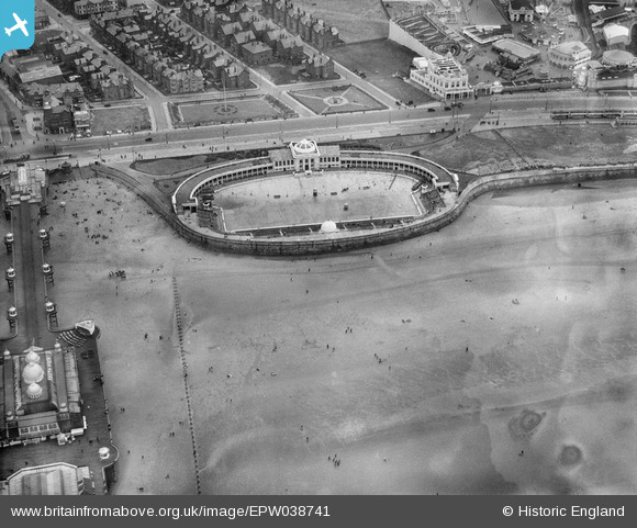
EPW038741 ENGLAND (1932). South Shore Baths, Blackpool, 1932
© Copyright OpenStreetMap contributors and licensed by the OpenStreetMap Foundation. 2024. Cartography is licensed as CC BY-SA.
Nearby Images (11)
EPW038741

EPW038917

EPW029209

EAW023419

EAW020133

EAW026232

EPW012491

EPW002075

EPW002060

EPW038742

EAW020134

Details
| Title | [EPW038741] South Shore Baths, Blackpool, 1932 |
| Reference | EPW038741 |
| Date | June-1932 |
| Link | |
| Place name | BLACKPOOL |
| Parish | |
| District | |
| Country | ENGLAND |
| Easting / Northing | 330379, 433614 |
| Longitude / Latitude | -3.0570204991813, 53.793958017226 |
| National Grid Reference | SD304336 |
Pins
 SteveAUS |
Wednesday 27th of February 2013 02:58:32 AM |


