
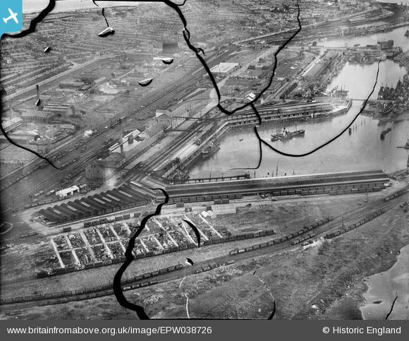
EPW038726 ENGLAND (1932). The Fish Dock and environs, Fleetwood, 1932. This image has been produced from a damaged negative.
© Copyright OpenStreetMap contributors and licensed by the OpenStreetMap Foundation. 2024. Cartography is licensed as CC BY-SA.
Nearby Images (15)
EPW038726

EPW038725

EAW023417

EPW038729

EPW038724

EPW038727

EPW038728

EPW038909

EPW038906

EPW038907

EPW038908

EPW003039

EAW036976

EPW003037

EPW038730

Details
| Title | [EPW038726] The Fish Dock and environs, Fleetwood, 1932. This image has been produced from a damaged negative. |
| Reference | EPW038726 |
| Date | June-1932 |
| Link | |
| Place name | FLEETWOOD |
| Parish | FLEETWOOD |
| District | |
| Country | ENGLAND |
| Easting / Northing | 333267, 446911 |
| Longitude / Latitude | -3.0160720077028, 53.913843459905 |
| National Grid Reference | SD333469 |
Pins
Be the first to add a comment to this image!


