
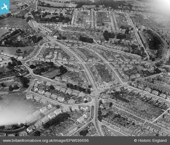
EPW036696 ENGLAND (1931). Housing at Hillsborough and Wadsley, Sheffield, 1931
© Copyright OpenStreetMap contributors and licensed by the OpenStreetMap Foundation. 2024. Cartography is licensed as CC BY-SA.
Nearby Images (9)
EPW036696

EPW036688

EPW036694

EPW036695

EPW036692

EPW036691

EPW036693

EPW036690

EPW036689

Details
| Title | [EPW036696] Housing at Hillsborough and Wadsley, Sheffield, 1931 |
| Reference | EPW036696 |
| Date | 14-September-1931 |
| Link | |
| Place name | SHEFFIELD |
| Parish | |
| District | |
| Country | ENGLAND |
| Easting / Northing | 432605, 390294 |
| Longitude / Latitude | -1.5094711784786, 53.4081921639 |
| National Grid Reference | SK326903 |
Pins
 sum0 |
Wednesday 15th of April 2020 09:53:35 PM | |
sum0 |
Wednesday 15th of April 2020 09:53:22 PM | |
stoneballs |
Thursday 6th of March 2014 09:04:28 PM | |
stoneballs |
Thursday 6th of March 2014 09:03:39 PM | |
stoneballs |
Thursday 6th of March 2014 09:02:59 PM | |
JER |
Thursday 16th of January 2014 04:43:17 PM | |
bayleaf |
Friday 14th of June 2013 07:09:55 PM | |
bayleaf |
Friday 14th of June 2013 07:09:24 PM | |
bayleaf |
Friday 14th of June 2013 07:08:57 PM | |
bayleaf |
Friday 14th of June 2013 07:08:15 PM |


