
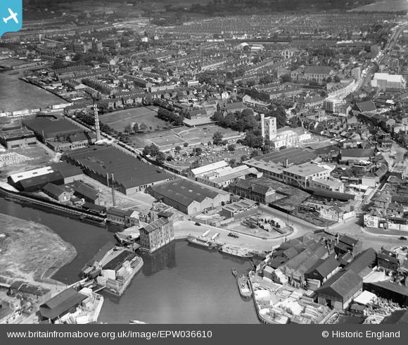
EPW036610 ENGLAND (1931). Town Quay and the town centre, Barking, from the south-west, 1931
© Copyright OpenStreetMap contributors and licensed by the OpenStreetMap Foundation. 2024. Cartography is licensed as CC BY-SA.
Nearby Images (13)
EPW036610

EAW043567

EAW032562

EAW032565

EAW032566

EAW032563

EAW032567

EAW032561

EAW032564

EAW032560

EAW032568

EPW036611

EPW036605

Details
| Title | [EPW036610] Town Quay and the town centre, Barking, from the south-west, 1931 |
| Reference | EPW036610 |
| Date | September-1931 |
| Link | |
| Place name | BARKING |
| Parish | |
| District | |
| Country | ENGLAND |
| Easting / Northing | 543943, 183738 |
| Longitude / Latitude | 0.075557990696811, 51.533692371387 |
| National Grid Reference | TQ439837 |


