
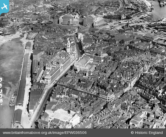
EPW036506 ENGLAND (1931). The Guildhall, Alfred Gelder Street and environs, Kingston upon Hulll, 1931
© Copyright OpenStreetMap contributors and licensed by the OpenStreetMap Foundation. 2024. Cartography is licensed as CC BY-SA.
Nearby Images (8)
EPW036506

EPW012813

EPW036503

EPW010792

EPW036504

EAW046135

EAW015657

EPW010789

Details
| Title | [EPW036506] The Guildhall, Alfred Gelder Street and environs, Kingston upon Hulll, 1931 |
| Reference | EPW036506 |
| Date | August-1931 |
| Link | |
| Place name | KINGSTON UPON HULL |
| Parish | |
| District | |
| Country | ENGLAND |
| Easting / Northing | 510020, 428802 |
| Longitude / Latitude | -0.33157158864391, 53.743748257005 |
| National Grid Reference | TA100288 |
Pins
 Edmund |
Thursday 22nd of November 2018 11:03:52 AM | |
John Wass |
Saturday 7th of January 2017 08:55:57 PM | |
John Wass |
Saturday 7th of January 2017 08:53:23 PM | |
John Wass |
Saturday 7th of January 2017 08:51:37 PM | |
John Wass |
Saturday 7th of January 2017 08:50:05 PM | |
Val |
Saturday 26th of November 2016 02:13:12 PM | |
John Wass |
Monday 29th of June 2015 12:12:36 PM | |
John Wass |
Monday 5th of January 2015 03:07:47 PM | |
John Wass |
Friday 21st of November 2014 08:14:05 PM | |
Hargow |
Thursday 9th of May 2013 10:54:03 AM | |
Looking at the top left hand corner, filling in had already started. |
John Wass |
Friday 21st of November 2014 08:13:08 PM |


