
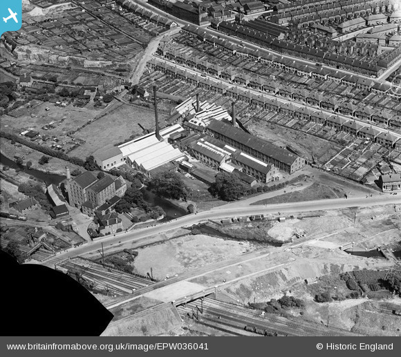
EPW036041 ENGLAND (1931). The Bobbers Mill Bleaching and Dyeing Works, Chadwick Road and Bobbers Mill Bridge under construction, Nottingham, 1931. This image has been produced from a damaged negative.
© Copyright OpenStreetMap contributors and licensed by the OpenStreetMap Foundation. 2024. Cartography is licensed as CC BY-SA.
Nearby Images (16)
EPW036041

EPW036044

EPW036039

EPW036042

EPW036045

EPW036047

EPW036048

EPW036043

EPW036040

EPW036046

EPW054123

EPW054124

EPW054121

EPW054120

EPW054122

EPW054119

Details
| Title | [EPW036041] The Bobbers Mill Bleaching and Dyeing Works, Chadwick Road and Bobbers Mill Bridge under construction, Nottingham, 1931. This image has been produced from a damaged negative. |
| Reference | EPW036041 |
| Date | July-1931 |
| Link | |
| Place name | NOTTINGHAM |
| Parish | |
| District | |
| Country | ENGLAND |
| Easting / Northing | 455104, 341359 |
| Longitude / Latitude | -1.1794541156927, 52.966445406117 |
| National Grid Reference | SK551414 |
Pins
Be the first to add a comment to this image!


