
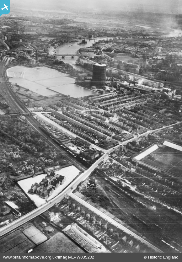
EPW035232 ENGLAND (1931). The Kew Bridge Water Works and environs, Brentford, 1931. This image has been produced from a copy-negative.
© Copyright OpenStreetMap contributors and licensed by the OpenStreetMap Foundation. 2024. Cartography is licensed as CC BY-SA.
Nearby Images (4)
EPW035232

EPW060317

EPW035094

EPW059939

Details
| Title | [EPW035232] The Kew Bridge Water Works and environs, Brentford, 1931. This image has been produced from a copy-negative. |
| Reference | EPW035232 |
| Date | May-1931 |
| Link | |
| Place name | BRENTFORD |
| Parish | |
| District | |
| Country | ENGLAND |
| Easting / Northing | 518133, 178037 |
| Longitude / Latitude | -0.29831889213263, 51.488441205776 |
| National Grid Reference | TQ181780 |
Pins
 Leslie B |
Thursday 22nd of December 2022 04:58:39 PM | |
 Des Elmes |
Wednesday 6th of April 2016 02:43:38 PM | |
Des Elmes |
Wednesday 6th of April 2016 02:40:37 PM | |
Des Elmes |
Wednesday 6th of April 2016 02:38:42 PM | |
Des Elmes |
Wednesday 6th of April 2016 02:37:48 PM | |
 Class31 |
Tuesday 2nd of June 2015 10:54:31 AM |


