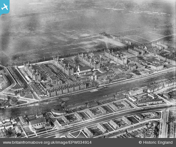
EPW034914 ENGLAND (1931). HM Prison Wormwood Scrubs and Westway, Wormwood Scrubs, 1931
© Copyright OpenStreetMap contributors and licensed by the OpenStreetMap Foundation. 2024. Cartography is licensed as CC BY-SA.
Nearby Images (5)
EPW034914

EPW034916

EPW034915

EAW009113

EPW056265

Details
| Title | [EPW034914] HM Prison Wormwood Scrubs and Westway, Wormwood Scrubs, 1931 |
| Reference | EPW034914 |
| Date | March-1931 |
| Link | |
| Place name | WORMWOOD SCRUBS |
| Parish | |
| District | |
| Country | ENGLAND |
| Easting / Northing | 522206, 181215 |
| Longitude / Latitude | -0.2385762628885, 51.516140155778 |
| National Grid Reference | TQ222812 |
Pins
 redmist |
Tuesday 26th of December 2023 02:40:50 PM | |
redmist |
Tuesday 26th of December 2023 02:39:08 PM | |
 |
KarenH |
Monday 11th of May 2020 08:39:53 AM |
johnnypritchett |
Thursday 22nd of January 2015 12:30:55 AM |