
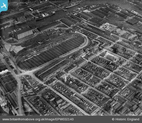
EPW032140 ENGLAND (1930). The Western Granaries and Grain Depot, Millwall, 1930
© Copyright OpenStreetMap contributors and licensed by the OpenStreetMap Foundation. 2024. Cartography is licensed as CC BY-SA.
Nearby Images (11)
EPW032140

EPW032141

EPW032143

EPW032138

EPW032139

EPW032136

EPW032137

EPW032142

EPW044128

EAW009114

EPW044135

Details
| Title | [EPW032140] The Western Granaries and Grain Depot, Millwall, 1930 |
| Reference | EPW032140 |
| Date | May-1930 |
| Link | |
| Place name | MILLWALL |
| Parish | |
| District | |
| Country | ENGLAND |
| Easting / Northing | 537393, 179631 |
| Longitude / Latitude | -0.020427554633474, 51.498414651667 |
| National Grid Reference | TQ374796 |
Pins
Be the first to add a comment to this image!


