
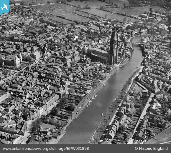
EPW031898 ENGLAND (1930). St Botolph's Church, The Haven and environs, Boston, 1930
© Copyright OpenStreetMap contributors and licensed by the OpenStreetMap Foundation. 2024. Cartography is licensed as CC BY-SA.
Nearby Images (8)
EPW031898

EAW035450

EPW031900

EPW031901

EPW031896

EAW035449

EAW035448

EAW035451

Details
| Title | [EPW031898] St Botolph's Church, The Haven and environs, Boston, 1930 |
| Reference | EPW031898 |
| Date | May-1930 |
| Link | |
| Place name | BOSTON |
| Parish | |
| District | |
| Country | ENGLAND |
| Easting / Northing | 532622, 344267 |
| Longitude / Latitude | -0.024482978703689, 52.979006786135 |
| National Grid Reference | TF326443 |
Pins
 Triggy |
Friday 24th of January 2014 08:40:15 PM |


