
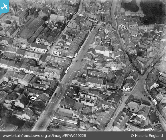
EPW029228 ENGLAND (1929). Washington Street and environs, Workington, 1929
© Copyright OpenStreetMap contributors and licensed by the OpenStreetMap Foundation. 2024. Cartography is licensed as CC BY-SA.
Nearby Images (4)
EPW029228

EPW029226

EPW029225

EPW029221

Details
| Title | [EPW029228] Washington Street and environs, Workington, 1929 |
| Reference | EPW029228 |
| Date | 12-September-1929 |
| Link | |
| Place name | WORKINGTON |
| Parish | WORKINGTON |
| District | |
| Country | ENGLAND |
| Easting / Northing | 300511, 528607 |
| Longitude / Latitude | -3.5418193750651, 54.642635657038 |
| National Grid Reference | NY005286 |
Pins
 Roland |
Thursday 24th of July 2014 08:45:05 PM | |
Roland |
Thursday 24th of July 2014 08:40:15 PM | |
Roland |
Thursday 24th of July 2014 08:39:33 PM | |
Roland |
Thursday 24th of July 2014 08:38:58 PM | |
Roland |
Thursday 24th of July 2014 08:38:07 PM | |
Roland |
Thursday 24th of July 2014 08:36:58 PM | |
Roland |
Thursday 24th of July 2014 08:36:15 PM |


