
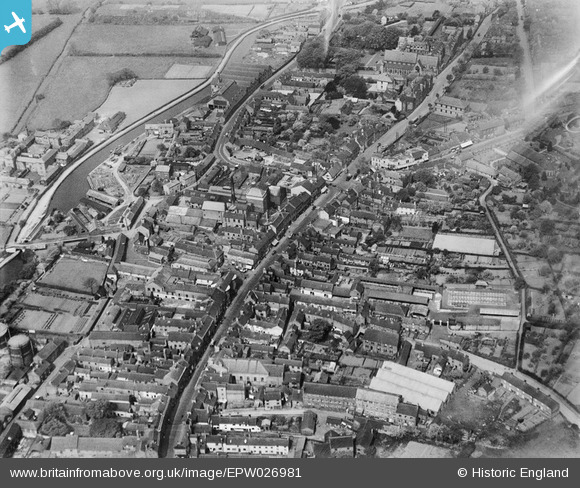
EPW026981 ENGLAND (1929). The High Street and town centre, Stone, 1929
© Copyright OpenStreetMap contributors and licensed by the OpenStreetMap Foundation. 2024. Cartography is licensed as CC BY-SA.
Nearby Images (30)
EPW026981

EPW042629

EPW042627

EPW042628

EPW026984

EPW058404

EPW047679

EPW058407

EPW026985

EPW058371

EPW053351

EPW058366

EPW020073

EPW058370

EPW058368

EPW026986

EPW058367

EPW020071

EPW058365

EPW058372

EPW058369

EPW053350

EPW042624

EPW042625

EPW042626

EPW042630

EPW042631

EPW042632

EPW026979

EPW058406

Details
| Title | [EPW026981] The High Street and town centre, Stone, 1929 |
| Reference | EPW026981 |
| Date | May-1929 |
| Link | |
| Place name | STONE |
| Parish | STONE |
| District | |
| Country | ENGLAND |
| Easting / Northing | 390162, 333921 |
| Longitude / Latitude | -2.1462785600994, 52.902317276016 |
| National Grid Reference | SJ902339 |
Pins
Be the first to add a comment to this image!


