
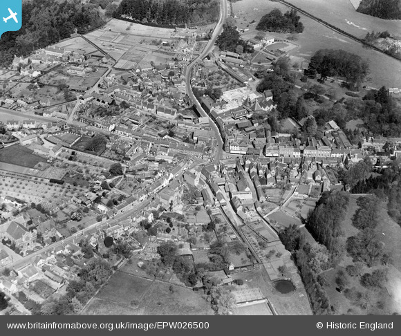
EPW026500 ENGLAND (1929). The Market Place and environs, Ampthill, 1929
© Copyright OpenStreetMap contributors and licensed by the OpenStreetMap Foundation. 2024. Cartography is licensed as CC BY-SA.
Nearby Images (7)
EPW026500

EAW037765

EAW037766

EPW026496

EPW035864

EPW026497

EPW026502

Details
| Title | [EPW026500] The Market Place and environs, Ampthill, 1929 |
| Reference | EPW026500 |
| Date | May-1929 |
| Link | |
| Place name | AMPTHILL |
| Parish | AMPTHILL |
| District | |
| Country | ENGLAND |
| Easting / Northing | 503467, 238112 |
| Longitude / Latitude | -0.49160487729564, 52.031331292635 |
| National Grid Reference | TL035381 |
Pins
 melgibbs |
Tuesday 26th of November 2013 11:54:54 AM | |
 |
melgibbs |
Tuesday 26th of November 2013 11:53:59 AM |
 |
melgibbs |
Tuesday 26th of November 2013 11:52:05 AM |
 |
melgibbs |
Tuesday 26th of November 2013 11:49:56 AM |
melgibbs |
Friday 22nd of November 2013 08:56:45 PM |


