
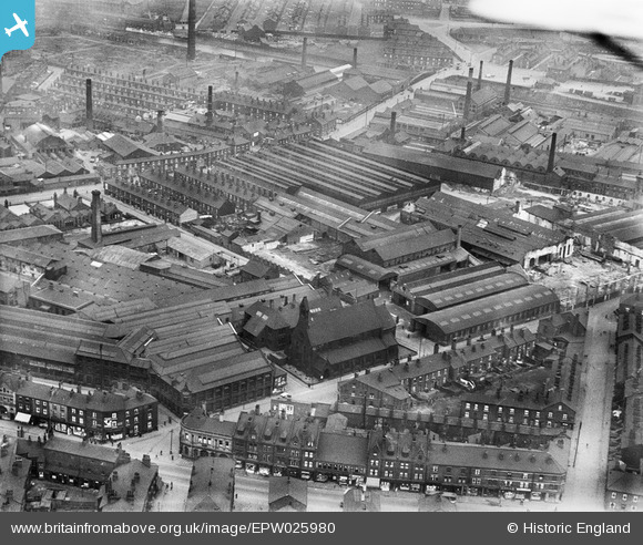
EPW025980 ENGLAND (1929). The George Mann and Co Engineering Works and St Silas' Church, Hunslet, 1929
© Copyright OpenStreetMap contributors and licensed by the OpenStreetMap Foundation. 2024. Cartography is licensed as CC BY-SA.
Nearby Images (19)
EPW025980

EPW025978

EPW026001

EPW025982

EPW025976

EPW025981

EPW025977

EPW025979

EPW026002

EPW025987

EPW025985

EPW025986

EPW025983

EPW025984

EPW025988

EPW028907

EPW028904

EPW028905

EPW028906

Details
| Title | [EPW025980] The George Mann and Co Engineering Works and St Silas' Church, Hunslet, 1929 |
| Reference | EPW025980 |
| Date | 11-April-1929 |
| Link | |
| Place name | HUNSLET |
| Parish | |
| District | |
| Country | ENGLAND |
| Easting / Northing | 431129, 432197 |
| Longitude / Latitude | -1.5274918329338, 53.78494791384 |
| National Grid Reference | SE311322 |
Pins
 trevorsboy |
Thursday 13th of October 2016 04:35:48 PM | |
 Class31 |
Monday 25th of February 2013 03:07:07 PM | |
Class31 |
Monday 25th of February 2013 02:05:11 PM | |
Class31 |
Monday 25th of February 2013 01:19:52 PM | |
Class31 |
Monday 25th of February 2013 11:19:39 AM | |
Class31 |
Sunday 24th of February 2013 10:54:10 PM | |
Class31 |
Sunday 24th of February 2013 10:43:36 PM | |
Class31 |
Sunday 24th of February 2013 09:55:03 PM | |
Class31 |
Sunday 24th of February 2013 09:43:20 PM |


