
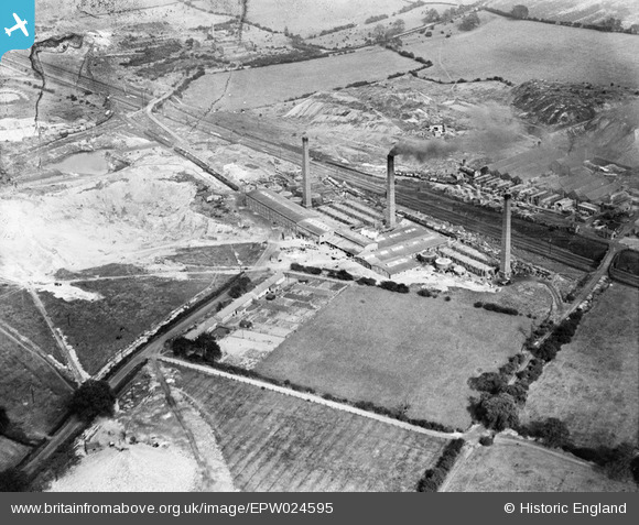
EPW024595 ENGLAND (1928). The Stoneware Limited Works, Whateley, 1928
© Copyright OpenStreetMap contributors and licensed by the OpenStreetMap Foundation. 2024. Cartography is licensed as CC BY-SA.
Nearby Images (22)
EPW024595

EPW044459

EPW024599

EPW024598

EPW044463

EPW024601

EPW024609

EPW024600

EPW024604

EPW024611

EPW044460

EPW024607

EPW024820

EPW024610

EPW024603

EPW024597

EPW044461

EPW024596

EPW024608

EPW024602

EPW044462

EPW024605

Details
| Title | [EPW024595] The Stoneware Limited Works, Whateley, 1928 |
| Reference | EPW024595 |
| Date | September-1928 |
| Link | |
| Place name | WHATELEY |
| Parish | KINGSBURY |
| District | |
| Country | ENGLAND |
| Easting / Northing | 421713, 299183 |
| Longitude / Latitude | -1.6794574870775, 52.589658022697 |
| National Grid Reference | SP217992 |
Pins
 johnny {strip} |
Sunday 3rd of March 2013 10:11:46 PM | |
johnny {strip} |
Sunday 3rd of March 2013 09:02:45 PM |


