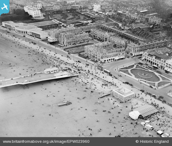
EPW023960 ENGLAND (1928). The Royal Parade, Weston-Super-Mare, 1928
© Copyright OpenStreetMap contributors and licensed by the OpenStreetMap Foundation. 2024. Cartography is licensed as CC BY-SA.
Nearby Images (19)
EPW023960

EPW023970

EAW015057

EPW048457

EPW039932

EAW025155

EPW051716

EAW015056

EPW048443

EPW001039

EPW048456

EPW039936

EPW039934

EAW016133

EPW023969

EPW051708

EAW056067

EAW016134

EAW015058

Details
| Title | [EPW023960] The Royal Parade, Weston-Super-Mare, 1928 |
| Reference | EPW023960 |
| Date | September-1928 |
| Link | |
| Place name | WESTON-SUPER-MARE |
| Parish | WESTON-SUPER-MARE |
| District | |
| Country | ENGLAND |
| Easting / Northing | 331733, 161400 |
| Longitude / Latitude | -2.9803213624275, 51.347074858751 |
| National Grid Reference | ST317614 |
Pins
 John W |
Tuesday 10th of January 2017 09:45:33 PM | |
 Alan McFaden |
Saturday 19th of October 2013 01:27:17 PM | |
Alan McFaden |
Saturday 19th of October 2013 01:25:46 PM |